Josephine County, OR

Wildfires

RVEM
/ Categories: Know Your Hazards
Wildfires 5956

Fire is a natural element in forest ecosystems. Today, more people are taking up residence in the forests and rangelands - and thus becoming part of the wildland/urban interface - where the urban environment meets the wild. Residents living in wild land/urban interface areas should be aware of the danger of wildfire and prepare accordingly.

There are basically three ways that structure fires ignite from forest fires:

  • When fire reaches such intense radiant heat that a nearby combustible starts burning.
  • When the fire burns right to an object or right to the structure, causing the flames to directly touch  and ignite something that will burn.
  • When fiery embers, also known as firebrands, fly through the air and land on the structure or combustibles, starting a fire.

The Home Ignition Zone (HIZ)

The HIZ includes your home and the immediate area surrounding your home, up to 200' from the home depending on terrain and vegetation. Keeping your HIZ as fire-safe as possible will reduce the chance that your home will ignite during a wildfire.Defensible Space Graphic
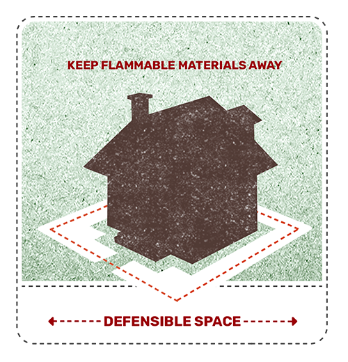
Your Home:

  • Replace wood shake roofs with non-flammable roofing material.
  • Remove leaves and needles from gutters, roofs and decks.
  • Remove tree limbs that hang over the roof.
  • Keep decks free of flammable lawn furniture, door mats, etc.
  • Screen vents and areas under decks with 1/8" metal mesh to keep embers from getting in your house.
  • Store firewood in a safe location - at least 30 feet away from your home and deck.

Within 30 Feet of Your Home:

  • Maintain 30 feet around your home - lean, green and clean. Remove dead vegetation and keep dry grass trimmed to 4 inches tall.
  • Plants directly near the home should be carefully chosen (ideally they should be of a fire-resistant nature) and maintained (well-watered and free of dead materials that could ignite during a wildfire).
  • Flammable brush Juniper, for example) should be removed.

Within 100 Feet of Your Home:

  • Remove dead plants and brush.
  • Remove low branches from trees and shrubs.
  • Mow grass to 6 inches.
  • Tree crowns should be spaced 10-15 feet apart to avoid dangerous crown fires.
  • Driveways leading to the home should also be clear of heavy vegetation on either side and should be wide enough to accommodate fire-suppression vehicles and personnel.

Be Prepared: Wildfires and High Wind Emergencies

Emergencies like wildfires and high winds can strike with little warning, posing significant risks to lives, property, and communities. Being prepared and knowing how to respond can make a crucial difference in ensuring safety and reducing damage. Here’s how to prepare for these types of emergencies:

Understanding the Risks

Wildfires: These are uncontrolled fires that spread rapidly through vegetation, fueled by dry conditions, wind, and other factors. They can destroy homes, infrastructure, and natural habitats within minutes.

High Wind Emergencies: Severe wind events, such as hurricanes, tornadoes, or strong local windstorms, can cause extensive damage by toppling trees, power lines, and buildings. They may also exacerbate wildfire risks by spreading flames quickly.

Preparing Your Emergency Plan

  1. Stay Informed: Monitor local weather reports and emergency alerts regularly. Sign up for emergency notifications from local authorities to receive timely updates.

  2. Create a Family Emergency Plan: Develop and practice an emergency evacuation plan with your family. Identify multiple evacuation routes and designate a meeting point in case you are separated.

  3. Prepare an Emergency Kit: Include essentials such as water, non-perishable food, medications, flashlight, batteries, first aid supplies, and important documents (e.g., insurance papers, identification).

  4. Protect Your Property:

    • Clear Defensible Space: Remove dry vegetation and debris from around your home to create a defensible space.
    • Harden Your Home: Use fire-resistant materials for roofing and siding. Install fire-resistant shutters or drapes.
  5. Secure Outdoor Items: Anchor or store outdoor furniture, decorations, and other items that could become projectiles in high winds.

During an Emergency

  1. Follow Authorities’ Instructions: If instructed to evacuate, do so immediately. Take your emergency kit and follow designated evacuation routes.

  2. Stay Indoors During High Winds: If indoors during high winds, stay away from windows and exterior walls. Seek shelter in a basement or interior room.

  3. Monitor the Situation: Stay informed about the progress of the emergency through local news, radio, or official updates.

After the Emergency

  1. Assess Damage Safely: Only return home when authorities declare it safe to do so. Be cautious of hazards such as downed power lines, weakened structures, and hot spots from wildfires.

  2. Check on Neighbors: Help neighbors who may need assistance, especially those with disabilities or who are elderly.

  3. Contact Your Insurance Company: Begin the process of documenting and filing claims for any damages to your property.

Conclusion

Being prepared for wildfires and high wind emergencies requires foresight and planning. By understanding the risks, creating a comprehensive emergency plan, and staying informed, you can protect yourself, your loved ones, and your property. Remember, preparedness is key to minimizing the impact of these emergencies and recovering quickly afterward.

Print


Josephine County
Emergency Management
500 NW 6th Street
Grants Pass, OR 97526
em@josephinecounty.gov
541-474-5300

Follow us on Facebook

Josephine County, Oregon Facebook
icon
Josephine County Emergency Management
3/17/2025
1 0
icon
Josephine County Emergency Management
3/16/2025
21 1
The weekend's excessive rainfall in Southern Oregon has created widespread road-related impacts on county-maintained roads. Nearly all areas of the county road system are being impacted. Known problem areas as of 1:30PM Sunday - Lower River Road @ Hunt Lane is closed due to high water. Gene Brown Road, O'Brien, closed due to high water Pleasant Valley Road, between Merlin Road and Tavis Road, closed due to high water Upper River Road @ Ft Vannoy School, high water 7000-8000 block of North Applegate Road, near Noble Dairy, significant debris across road, proceed with caution. This is NOT an all-inclusive list, as conditions continue to change. Drivers are reminded to limit travel to essential activities and allow themselves extra time to get to their destination. Each year, more deaths occur due to flooding than from any other thunderstorm related hazard. The Centers for Disease Control and Prevention report that over half of all flood-related drownings occur when a vehicle is driven into hazardous flood water. The next highest percentage of flood-related deaths is due to walking into or near flood waters. People underestimate the force and power of water. Many of the deaths occur in cars swept downstream. Many of these drownings are preventable. Never drive around the barriers blocking a flooded road. The road may have collapsed under that water. A mere 6 inches of fast-moving flood water can knock over an adult. It takes just 12 inches of rushing water to carry away most cars and just 2 feet of rushing water can carry away SUVs and trucks. It is NEVER safe to drive or walk into flood waters. Residents can get information on sandbag suppliers at www.rvem.org/News/sandbags-faq" target="_blank">https://www.rvem.org/News/sandbags-faq For other safety tips www.rvem.org Turn Around Don’t Drown, National Weather Service: https://www.weather.gov/safety/flood-turn-around-dont-drown
icon
Josephine County Emergency Management
3/16/2025
22 1
The weekend's excessive rainfall in Southern Oregon has created widespread road-related impacts on county-maintained roads. Nearly all areas of the county road system are being impacted. Known problem areas as of 1:30PM Sunday - Lower River Road @ Hunt Lane is closed due to high water. Gene Brown Road, O'Brien, closed due to high water Pleasant Valley Road, between Merlin Road and Tavis Road, closed due to high water Upper River Road @ Ft Vannoy School, high water 7000-8000 block of North Applegate Road, near Noble Dairy, significant debris across road, proceed with caution. This is NOT an all-inclusive list, as conditions continue to change. Drivers are reminded to limit travel to essential activities and allow themselves extra time to get to their destination. Each year, more deaths occur due to flooding than from any other thunderstorm related hazard. The Centers for Disease Control and Prevention report that over half of all flood-related drownings occur when a vehicle is driven into hazardous flood water. The next highest percentage of flood-related deaths is due to walking into or near flood waters. People underestimate the force and power of water. Many of the deaths occur in cars swept downstream. Many of these drownings are preventable. Never drive around the barriers blocking a flooded road. The road may have collapsed under that water. A mere 6 inches of fast-moving flood water can knock over an adult. It takes just 12 inches of rushing water to carry away most cars and just 2 feet of rushing water can carry away SUVs and trucks. It is NEVER safe to drive or walk into flood waters. Residents can get information on sandbag suppliers at www.rvem.org/News/sandbags-faq" target="_blank">https://www.rvem.org/News/sandbags-faq Other information about floods and safety tips www.rvem.org Turn Around Don’t Drown, National Weather Service: https://www.weather.gov/safety/flood-turn-around-dont-drown
icon
Josephine County Emergency Management
3/16/2025
4 0
UPDATE: 2/25/25 10:00am: Wayne has been located safely. * Date of Report: 02/24/2025 Case: 25-4214 Name: Wayne David Morris Age: 76 Sex: Male Race: White Height: 5'5" Weight: 180 Hair: Gray Eyes: Blue Information: Wayne was reported missing late Monday night. He was last seen on Vine Street around 3:00pm on 2/24/25. He was driving a gray 2020 Chevrolet Silverado with OR license plate 593MMB. The OnStar app shows the vehicle's last known location to be in the Hog Creek area around 4:30pm later that day. SAR has been activated. Please contact the Josephine County Sheriff's Office with any information. Phone: 541-474-5123
icon
Josephine County Emergency Management
2/25/2025
15 0
Update 02/03/2025 12:30pm: ODOT: SW Oregon: I-5 NB, MP 66: UPDATE - Crews have cleared stalled trucks in the northbound lanes of Interstate 5, 8 miles north of Grants Pass. Expect continued delays throughout the area due to winter conditions. Avoid travel until conditions improve. Visibility is limited; turn on headlights. Check road conditions at https://tripcheck.com/" target="_blank">https://tripcheck.com/ . More Info ODOT: SW Oregon: I-5 NB, MP 66: Expect delays in the northbound lanes of Interstate 5, 8 miles north of Grants Pass while crews work to clear stalled trucks blocking the road. Visibility is limited. Postpone travel until conditions improve. Do not detour on local or forest roads. Expect delays throughout the area due to winter conditions. Check road conditions at https://tripcheck.com/" target="_blank">https://tripcheck.com/ . More Info
icon
Josephine County Emergency Management
2/3/2025
13 0
Load more posts Loading